Tasmania is a state in Australia – yep, they have states. Tasmania is an island at the southern tip of Australia which puts it at the farthest point in Australia from the equator. It still seems weird to me that in this part of the world, the farther south you go the colder it gets, , does that make any sense to you? In fact Tasmania is just shy of being closer to Antarctica than it is to the equator.
Anyway, having had your geography lesson for the day, let’s leave it at that we went from lows in the 80°s – highs of 104° in the Outback to lows in the 30°s – highs in the 60°s in Tasmania. On top of that, we changed time zones again – no wonder I’m confused…
To add to the confusion, we rented a car here and THEY DRIVE ON THE WRONG SIDE!!!! Plus the roads are very narrow. Tom did all the driving, and I did most of the white-knuckle gripping of the armrest and gritting of the teeth. I’m proud of Tom – not one scratch or dent (on the car).
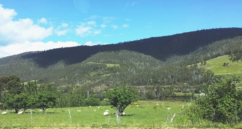
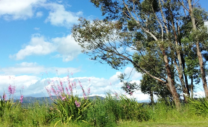
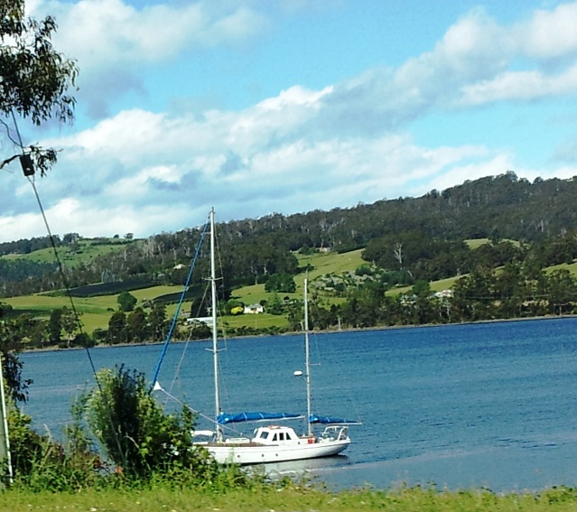
But on with the trip, we stayed in Hobart, the capital of Tasmania, at a great little place called Graham Court where we had a small apartment and cooking facilities – back to home cooked meals, yea!!! Hobart is what I would call a large sprawling town. It is hilly, green and lovely with pretty little houses and flowers in the yards, along the roads, in the meadows… serene tranquility (except for when we were driving).
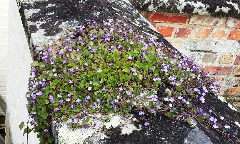
Driving into HobartA very pretty type of geranium. It grew everywhere.Charming housesGrazing sheepQuiet verdant vineyardsThe countryside was beautiful everywhere we went.Pretty, peaceful, pastoral settings.This pretty little ground cover grew right on the rock – no soil.Tranquility
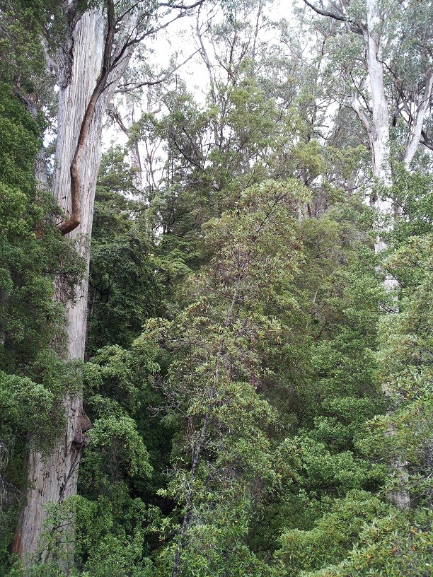
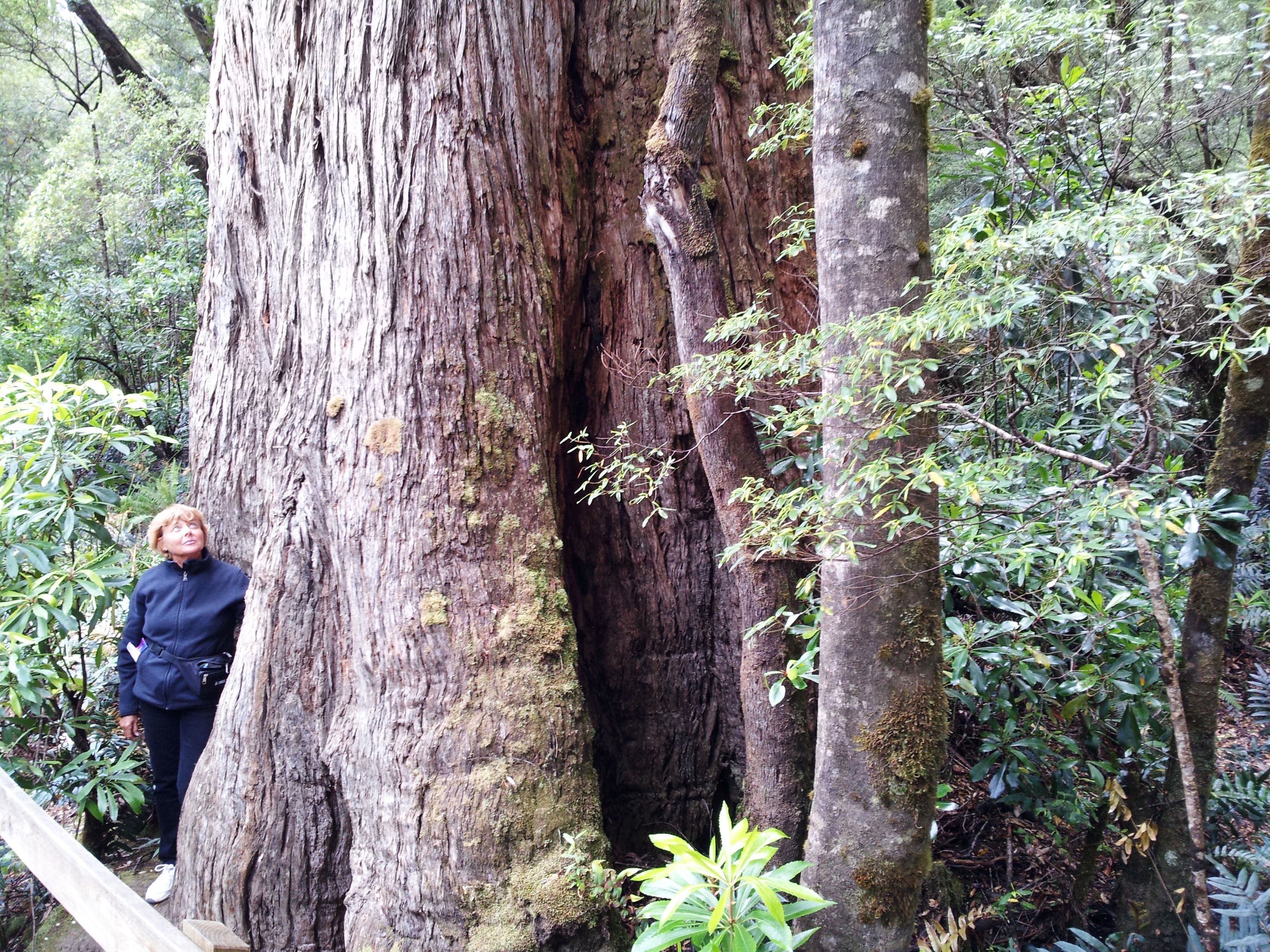
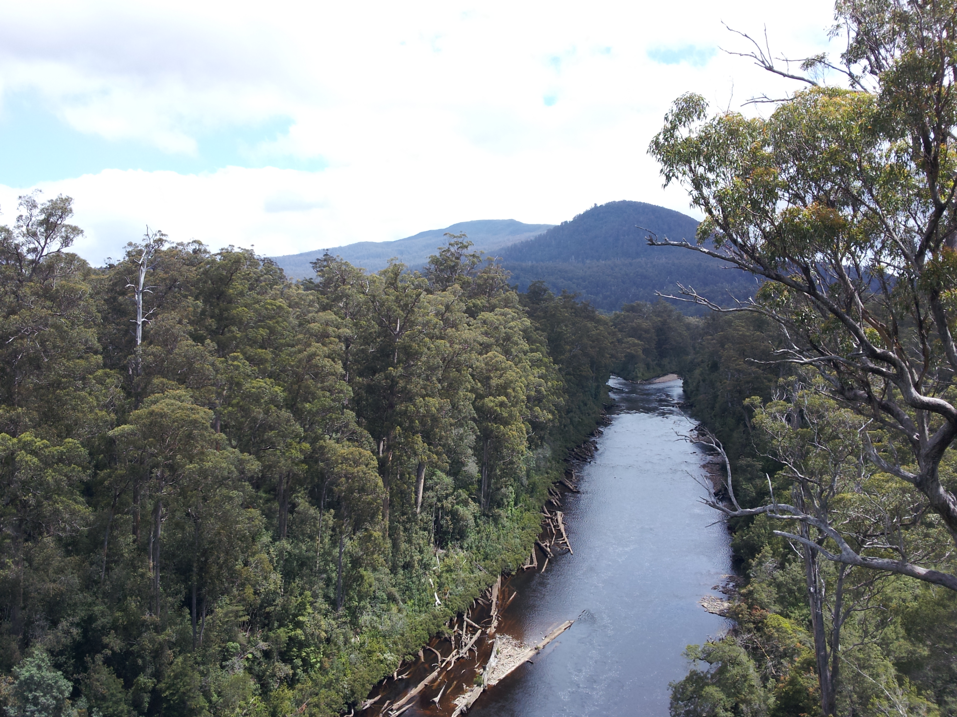
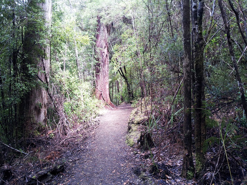
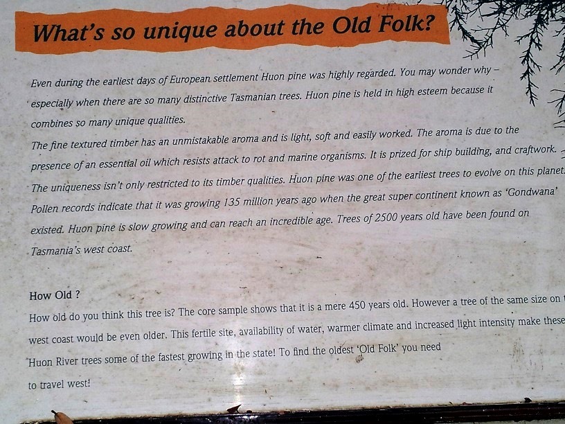
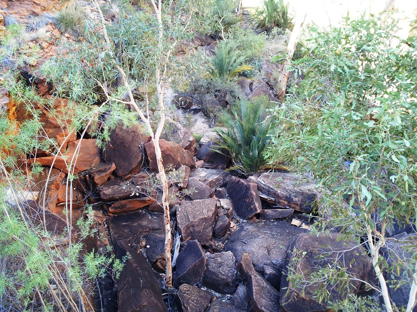
We spent our first full day at a place called Huon National Park. Huon is a type of pine tree that grows in this area and has beautifully grained wood that they use for building everything from ships to salt and pepper shakers. Huon National Park is a mixed forest – evergreens, deciduous trees (including gigantic eucalyptus trees), ferns, mosses, etc. – lush and fragrant.
The eucalyptus trees are huge.It is hard to portray the enormity of the eucalyptus trees in this area.
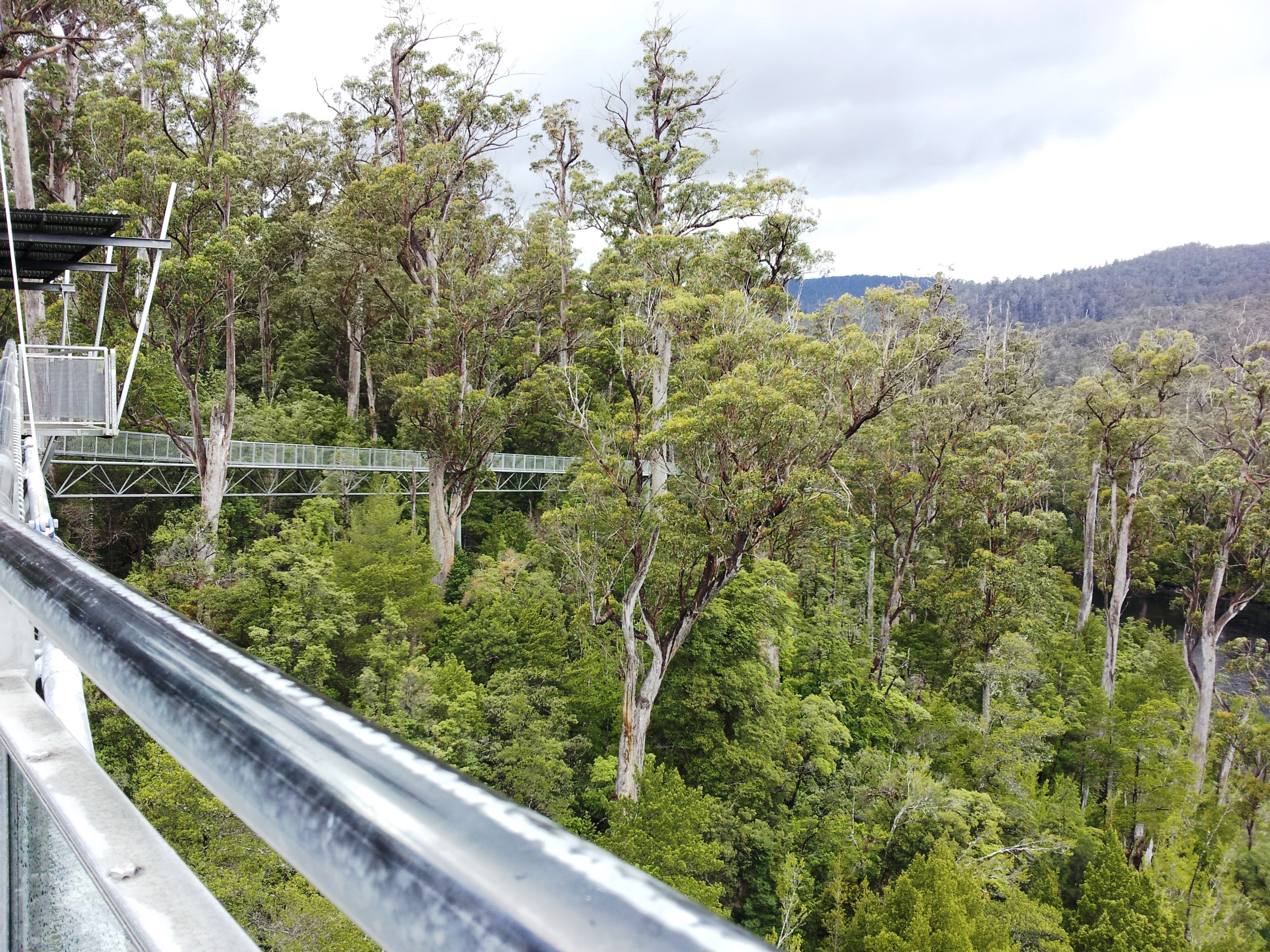
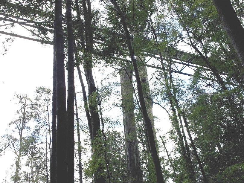
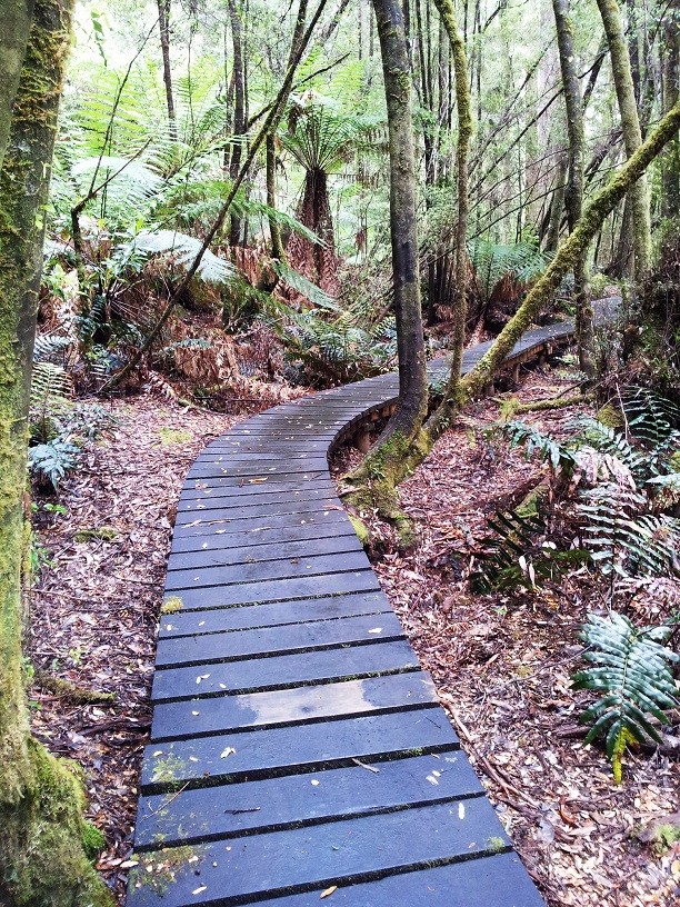
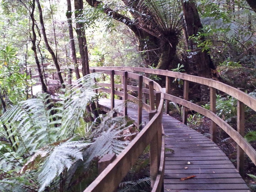
But one of the best things that this park has is The Tahune Airwalk!!! This was soooo cool! The airwalk is a long (1800 feet to be exact) walkway, but not just any walkway, this one rises to an average of 65 feet above the ground and to 156 feet above the river at the cantilever (that’s the arm that sticks out over the water without any support from below, eeeeek!) and wanders through the treetops. It is awesome! We walked along taking in the views and marveling at the scenery from above. It was fantastic.
The AirwalkThe airwalk from below.This is the cantilever from below. This arm sticks out over the river without any ground support at the end. It swayed in the wind – a little unnerving when we were standing up there.Tom and I way up and out on the cantilever.Yet another view of the cantilever. You have to look close (click to enlarge).
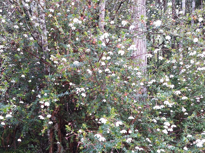
The Tahune (Aboriginal for “peaceful place by running water”)Park also has miles of trails and we spent the morning hiking around and enjoying the sights and reading about the history, the flora, and the fauna of the area.
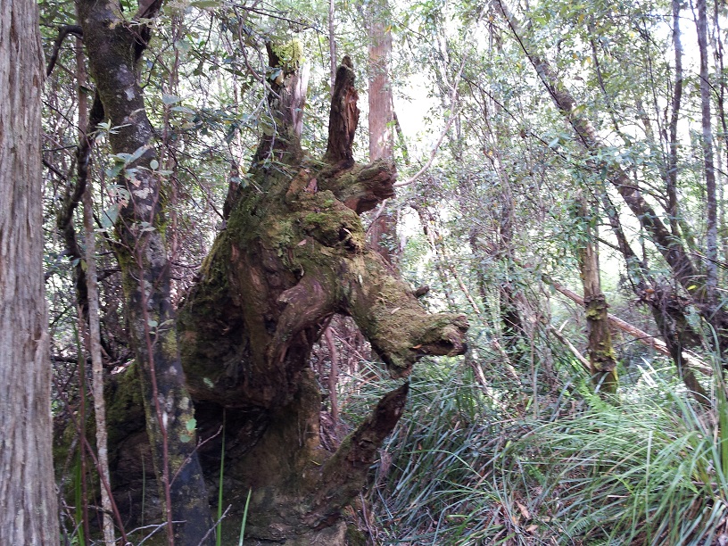
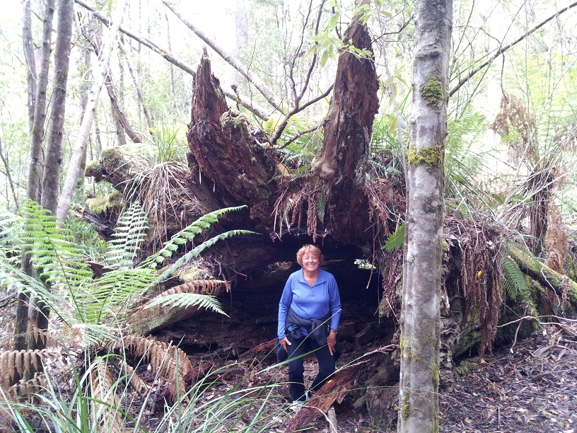
Peaceful Place by Running WatersFlower lined pathwaysThere were also really long swinging bridges.Hiking pathsThis huge fungi was the size of a large platter.Signs along the way gave information about the trees, bushes and surroundings.Walkways meandered through the forest and so did we.Winding bridgesA kangaroo in the wild!! Okay, it’s really just a log, but it kind of looks like a kangaroo.What a great den for some ot the wildlife.Tahune Airwalk Visitors Center
We took a leisurely break for lunch at the visitors’ center where we dined on salad and Bushman’s Beef Pie, delicious!
By the time we had finished, the sun had peeked through (I forgot to mention that Tasmania is one of the wettest places in Australia) so we rushed out to do the airwalk and many of the trails again. After about 6 miles total, we decided that we were pretty much spent so we left this peaceful place by running water and headed home with lovely memories and lots of pictures.
So after lunch our adventure in the Outback continued. JJ had been giving us background information some of which I shared in the last post. However, this is where the learning really started. This is where we began to learn the true lessons of this region – the stories of the Aboriginal people, the heart and history of The Red Center.
Uluru Cultural CenterThe displays told the stories of the past and present.
Our next excursion began with a stop at the Cultural Center at Uluru where we spent an hour or so reading and watching videos and learning a little bit about the Aboriginal culture.
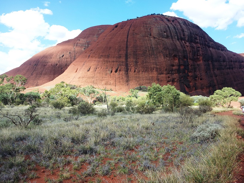
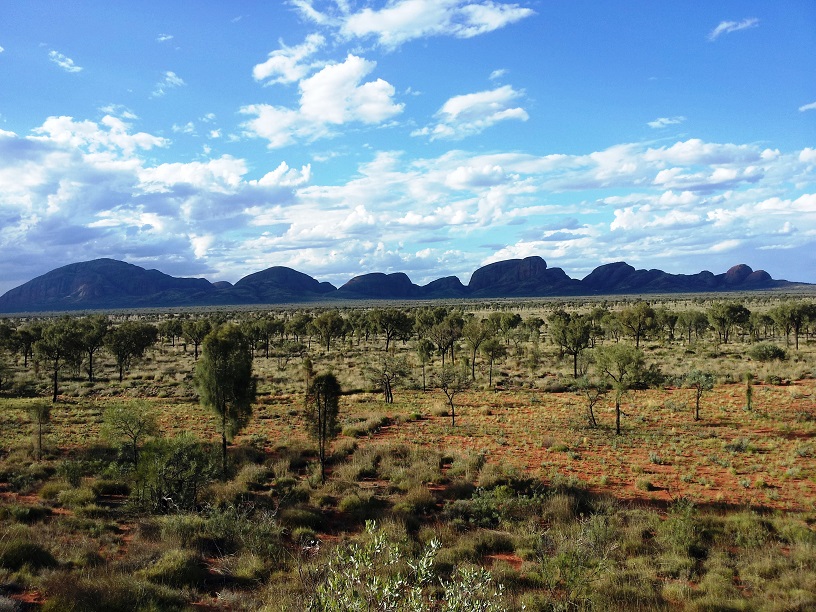
Then it was off to Kata Tjuta (Kah-tah Jutah).
Kata Tjuta (translation – Many Heads)
Kata Tjuta (Many Heads) is a formation of huge red rocks about 30 kilometers or 18 miles from Uluru. It is also a sacred place for the Aboriginal people. It was the place where the men performed the ceremonial rite of passage – the place where boys became men. These ceremonies are holy and the Aboriginal people are a private people. Their ceremonies are not shared with the world or even with the opposite sex. Let me explain. In the Aboriginal culture, there was a clear distinction between “men’s business” and “women’s business.” The men were the hunters. They were ones that did the wall paintings that told their stories – their history. And the grandfathers were the ones who taught their grandsons.
The women were the gatherers, the ones who held the knowledge of plants – what was edible and which plant could be used for a stomachache, a burn, to promote or prevent fertility. And the grandmothers were the ones who passed this knowledge on to their granddaughters. More about this later.
Kata Tjuta from a distance.Charli at Kata Tjuta
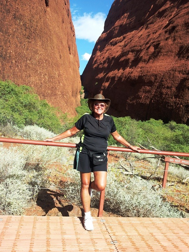
We arrived at Kata Tjuta at around 4:00PM and the temperature was hovering around 102°, but it was a dry heat which made it okay – NOT. Despite the temperature, we hiked the 1.5+ kilometers into a small canyon where we learned a bit more about the area and its history and sweated copious amount of bodily fluids. I should insert here that JJ had passed out 2 liter bottles of water to each of us, at the first station we stopped at, and laid down the rule – “If you don’t have your water with you, I won’t allow you to go with me on the excursions!”It seemed a little harsh at the time – not so much now. We hiked back to the van and it was off to the next stop – Sundowners (cocktails at sunset) and a sunset view of Uluru – now that works for me!
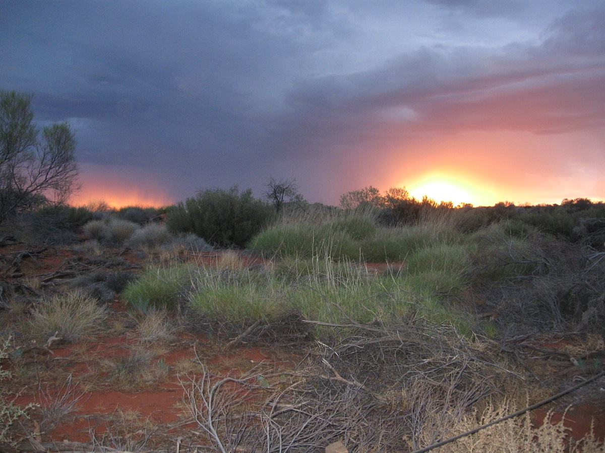
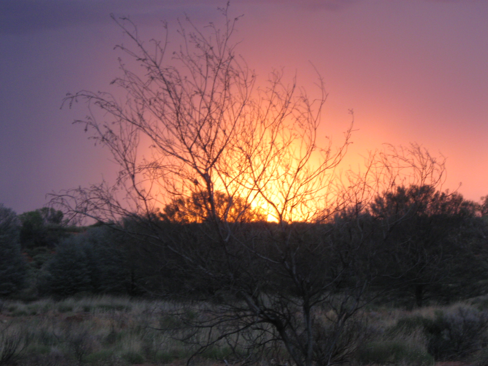
We arrived at exactly the right time to get set up, get our snacks and drinks, and to prepare for the impressive show of sunset at Uluru (JJ is very punctual). Unfortunately, Mother Nature was not in the mood – there was a pretty thick cloud cover so watching the sunset on Uluru was not happening…heavy sigh. But wait when we turned around toward the west, we were delighted with one of the most spectacular sunsets I have ever seen.
There was a thunderstorm in the middle of the sunset with spectacular flashes of lightning.Wow!We watch until it started to fade into night.
The colors were beautiful and in the center there was a thunderstorm showing off with amazing lightning flashes. The crowd was mesmerized and we stood watching in hushed amazement for nearly half an hour until it faded. Wow! Thank you Mother Nature.
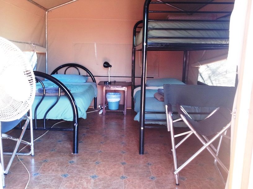
Not the Marriott, but we were sooo tired we didn’t care.
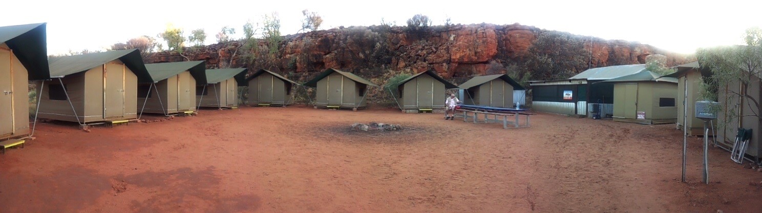
The next stop was camp, dinner – camel sausage (delicious and yeah, we rode a camel and ate camel all in the same day), kangaroo steak, salad, and desert – showers and bed by 8:30. We slept like the dead!
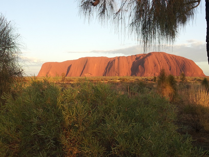
But not for very long, JJ had breakfast ready and was telling us we had 30 minutes until the bus left. That was at 4:30AM. We chowed down and left camp at precisely 5:00…ugh. We arrived at a hill near Uluru in time to watch the sunrise on the big red rock. In the still, early morning there was something majestic and magical about the place and we were to learn that this feeling is the spirit of Uluru.
Uluru at Sunrise
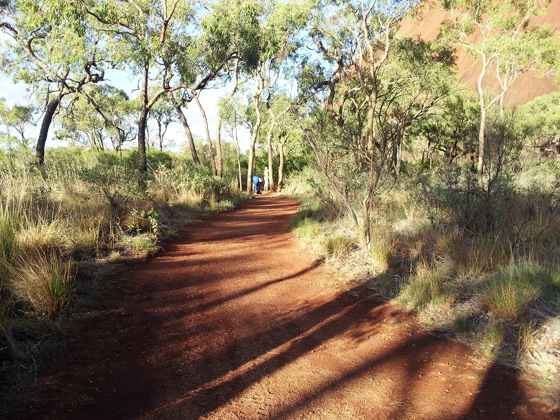
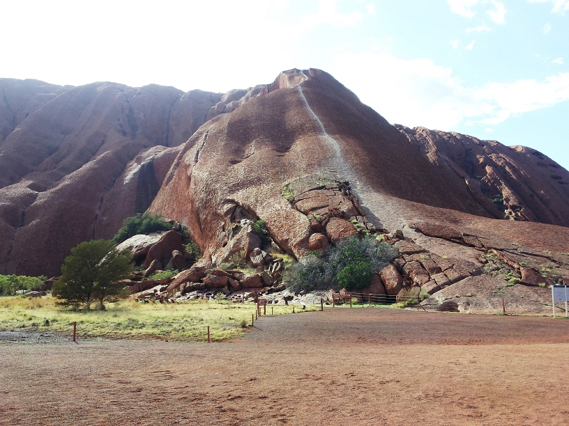
Then it was on to get up-close and personal with Uluru itself.
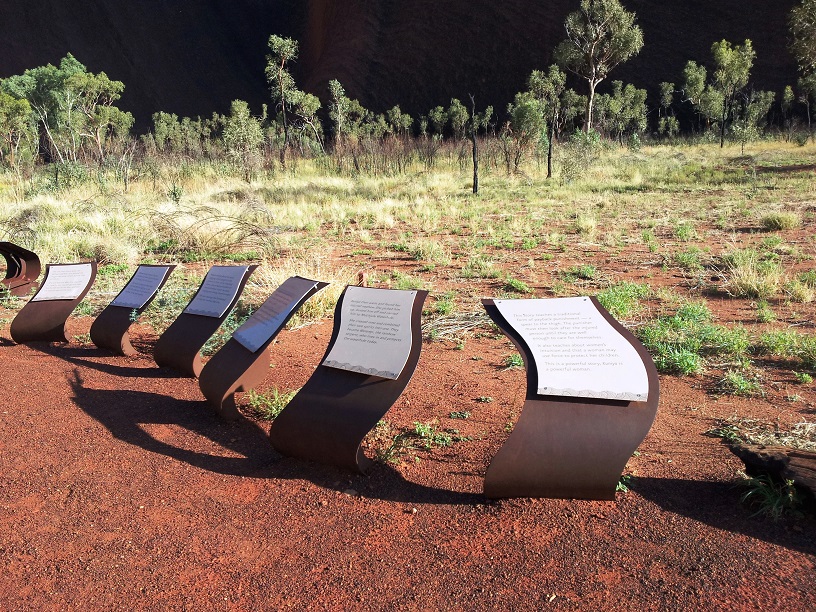
Plaques and signs along the way told the stories of the area.The path around the non-sacred part of Uluru.
We started out with a self-guided tour. Reading the plaques and signs along the way we walked about half way around, about 5 kilometers/3miles. The rock formations are fantastic and it took us about twice as long as it usually would to walk it because I couldn’t stop taking pictures.
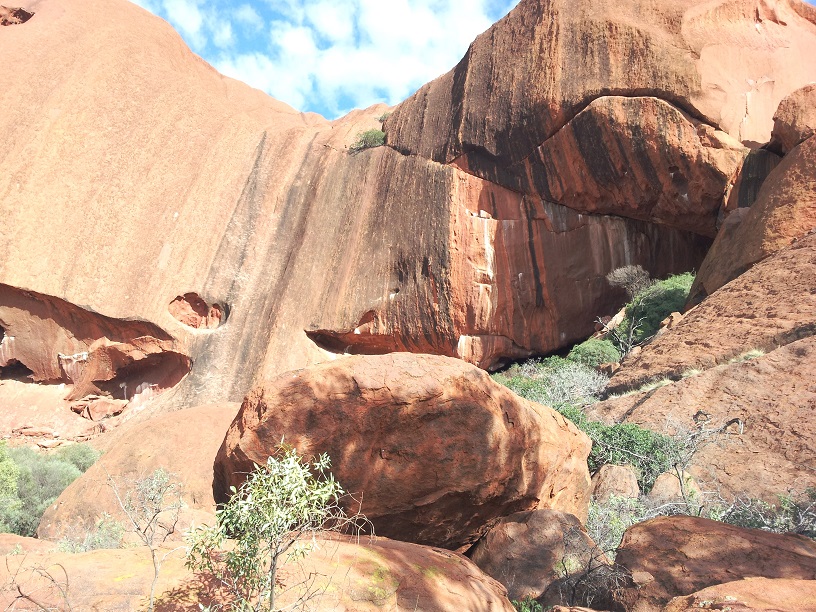
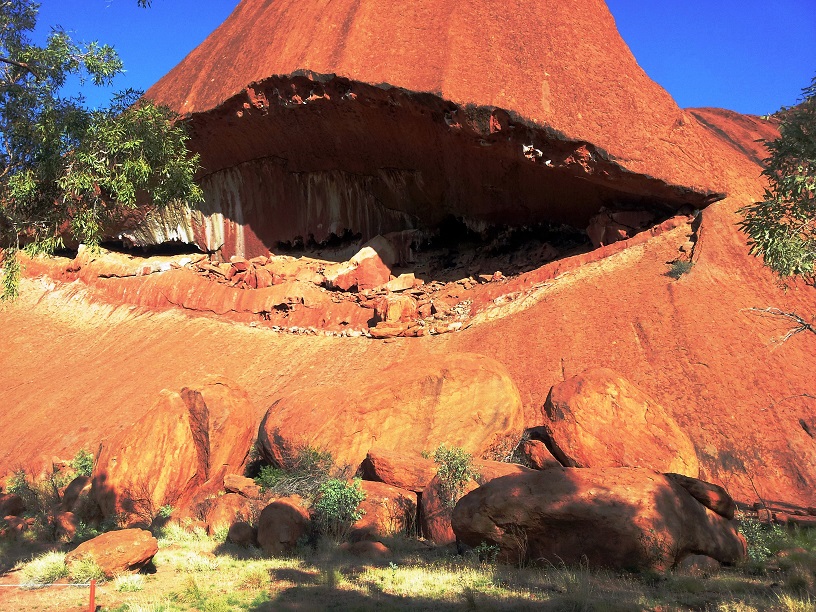
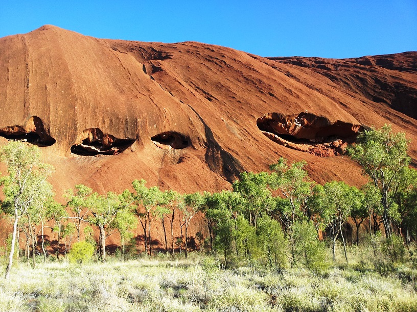
One of many faces of Uluru.This area has the nickname the Whale. It was awesome.Uluru is riddled with caves some used as classrooms and some for ceremonies.As I said, a place of many faces and moods.Our Mala guide, Vincent.
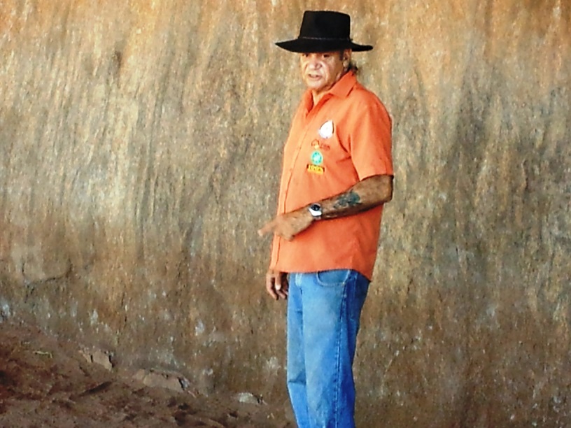
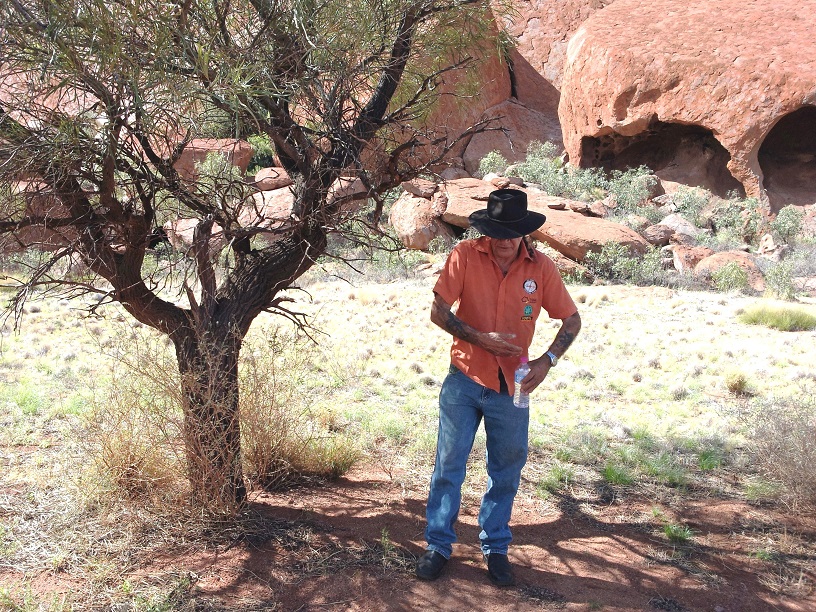
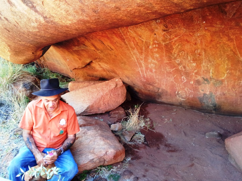
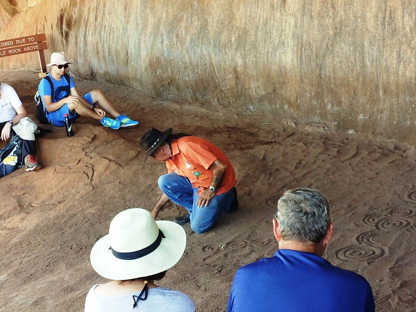
We finally met back up with JJ and the group at the designated time to meet with our Mala (one of the Aboriginal tribes) guide, Vincent. He would take us on the rest of the tour and explain a bit about the culture and history of the Aboriginal people and their relationship with Uluru.
The Aboriginal people had lived in Australia for over 33 thousand years and their numbers ranged in the 10s of thousands. They had developed a way of life allowed them to live and thrive in the harsh surroundings of the Australian Outback as well as in all the parts of Australia.
Vincent described more about men’s business and women’s business explaining that neither men nor women were dominant in the Aboriginal society. Each gender had its own jobs/”business”. They were dependent on each other and neither could survive without the other. They did not own the land but considered themselves a part of the land, a part of the natural order. For example, one of the practices the Aboriginal performed was back burning the land. They would set fire to the underbrush and large areas were allowed to burn. This practice served to get rid of dead brush, add much needed nitrogen to the soil, and it allowed the very hard seeds of the acacia plants and trees to crack so that they could sprout and grow. When the rains came, this bush area sprang to life with new growth providing food for the people and the animals of the area.
The trunk of this acacia is fire retardant allowing it to survive a forest fire. Throughout our trip we saw these trees with charred trunks and healthy green leaves.Fires clean out the dead underbrush, crack the dense seeds of the acacias and provide nitrogen for the soil and plants.
The Aboriginal people were an integral part of the process and the land.
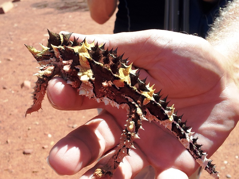
We got to see and hold this pretty little thorn devil.
Vincent talked about how boys were taught and how girls were taught. He explained how various plants were used for food and medicine. He spent over an hour with us pointing out caves, plants, animals,
telling us the stories and explaining the sacredness of Uluru to his people.
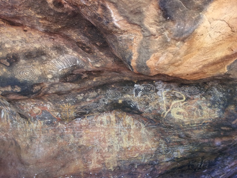
Cave DrawingsA classroom cave used for teaching young boys in the Aboriginal ways. Vincent described this wall as an Aboriginal chalk board.Vincent told us an Aboriginal story using the ancient symbols.
Using the ancient drawings and symbols, Vincent told us an Aboriginal story that was used to teach the children a morals lesson on honesty.
We left Uluru with a deeper understanding and respect for the people and the land.
Before we leave this part, I would like to point out that Vincent is college educated, a teacher, and for years, held an important position with a council that works with the Australian government in Aboriginal concerns. He works now to help his people and to educate those who come to Uluru.
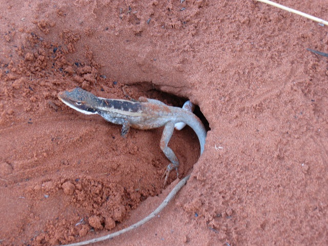
King’s Canyon ResortAt the resort we saw this lizard digging her hole, but our friend, Carey got the picture of her actually laying her eggs. How cool is that!
After lunch we broke camp and headed to the next campsite in King’s Canyon. It was a pretty long trip with a stop at King’s Canyon Resort for a break and a swim before heading on.
We arrived at our campsite in time to set up camp, have dinner, showers, and again collapse in our bunks. This Outback exploring is hard work.
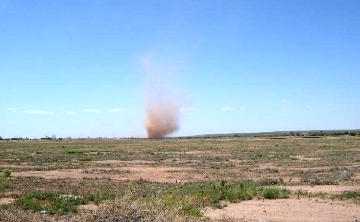
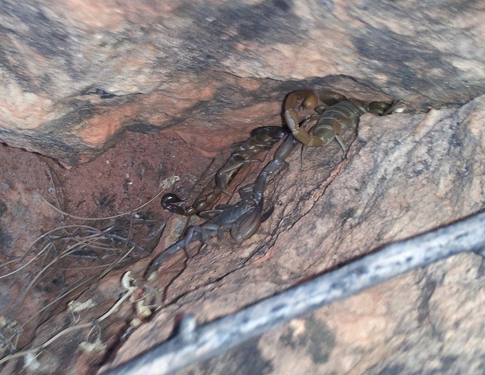
Just before dinner Tom and I headed for the restroom when we saw a dust devil, a tiny tornado, zipping across the field. That was amazing!Scorpions – there are three of them there.
JJ showed some mercy the next morning and didn’t ring the breakfast bell until 5:30. We trouped to the mess tent and found breakfast and a container of scorpions waiting on the table. JJ had generously collected them during the night for our perusal – thanks JJ. It gave me pause when I remembered trekking to the bathroom in the middle of the night in flip-flops…
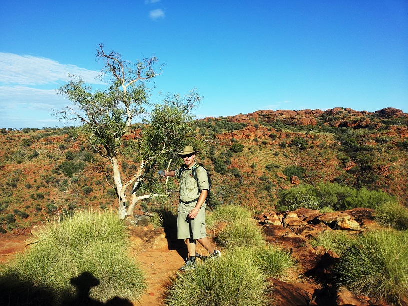
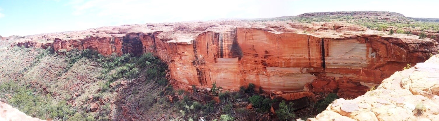
This was the beginning of the hike to the top of King’s Canyon – an invigorating way to start the day.
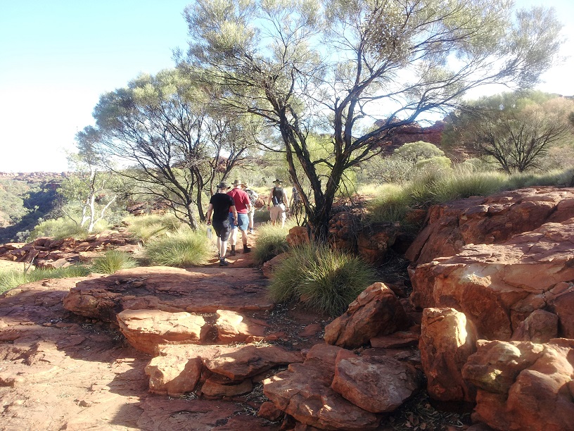
We were off and running by 6:30 and at our next hike by 7: 00. This one was a hike around the rim of the canyon. The only trouble with it was that we had to hike up to the rim – 120m/500ft and it was already in the mid 90°s.
None-the-less, armed with our water bottles, up we climbed, and we spent the next 3hrs hiking the rim, taking in the sites and JJ’s knowledge of the land.
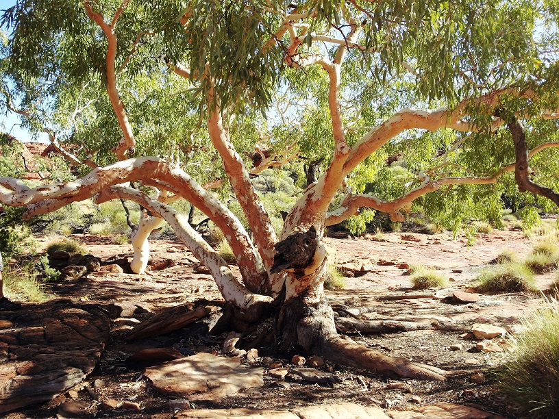
The white ghost gum, a species of eucalyptus, has a white powder covering it’s branches that acts as a sunscreen, with an SPF of 15, to help shield it from the brutal sun.The hike around the ridge of King’s Canyon took just over 3 hours with temperatures in the 100°+ range.Another white ghost gum. The name white ghost comes from the fact that they seem to glow at night.About Dead Sea Ripples (click to read)Real dead sea rocks
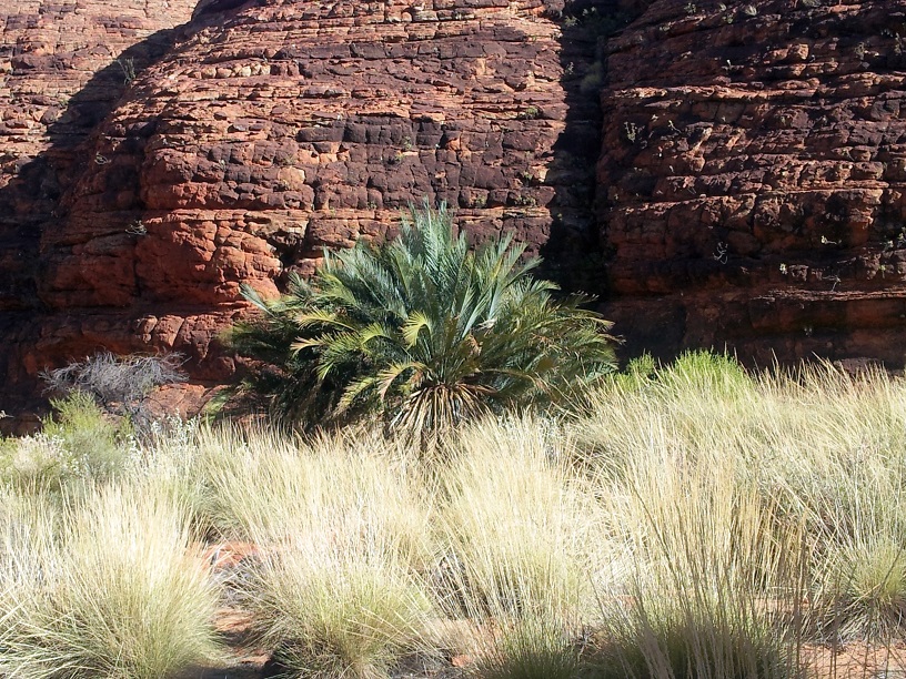
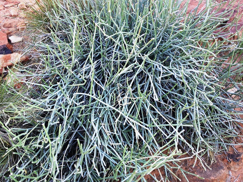
The Cycade is also known as the dinosaur plant because these plants were around when dinosaurs still roamed the earth. It grows 1 leaf a year. This one es estimated at about 500 years old.The sap of the ipyipy bush acts as an antiseptic and a bandage.
Looking down into the canyon.
Our motley crew up on the rim of the canyon.
The sights were incredible!
The Garden of Eden – a lovely respite from the heat and sun.We hiked down to the Garden of Eden a beautiful crevasse at the bottom of the canyon.
About ¾ of the way around, we hiked down into The Garden of Eden. It is a beautiful ravine at the bottom of the canyon where we stopped for a break and snacks.
Beautiful panoramic view. Notice the steps on the right.
Then we had to climb back up the other side.
The canyon wall from the far side of the rim.
By the time we made it around to the climb back down the thermometer was registering 104°. We made it back to the bus, barely. Was it worth it? After I’d cooled down and was back on the air-conditioned van – definitely. Seriously, it was incredibly beautiful and well worth the significant effort.
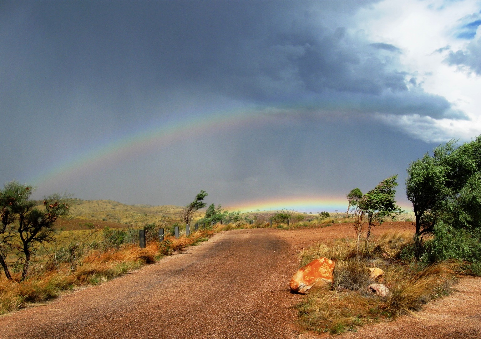
Then it was back to the bus, to camp for lunch, and then we were headed for the long journey home. But wait there’s more. I forgot to mention that this is the “rainy season” in Australia and so it is for the Red Center. When the annual rainfall is less than 2 inches per year, an excursion being spoiled by rain isn’t a big threat. We did get bits of rain every day on this trip but never enough to slow us down. That being said, we made a brief stop on the way home to look at a meteor crater. The skies were pretty clouded and just after we got off the bus the wind picked up and the skies opened up. The results other than getting wet were the most amazing thing I’ve ever seen, a gorgeous double rainbow – WOW!!!
A double rainbow, amazing!!!The colors were magnificent!
Isn’t nature astounding!!!!!
and what a way to end our adventure – a promise of things to come.
Our journey to the Red Center was illuminating and awe-inspiring. I am truly grateful for the experience and thank you for letting me share it with you.
It is said that a picture is worth a thousand words but the Outback is too large to photograph. So we’re beginning this post with a few definitions because to get the full experience there are some things you need to understand.
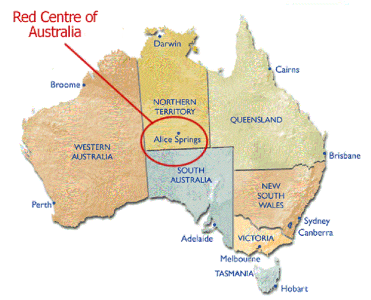
Alice Springs is a small city near the center of Australia and the only one within 1000 miles with an airport.
The Red Center
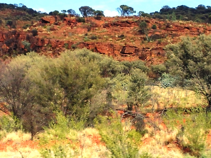
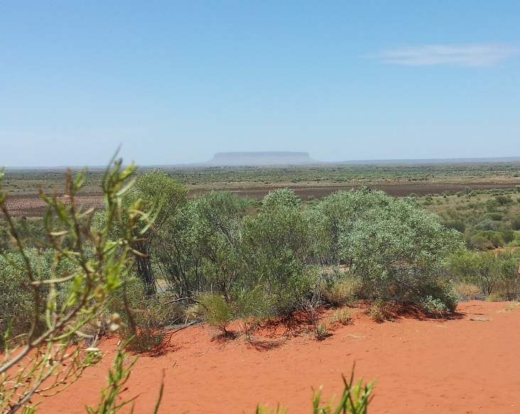
The Red Center – We have always heard and called it the Outback but Australians call it The Red Center. The soil in the center of Australia is rich in iron and, as you know, iron rusts even when it’s in the soil and in rocks so it is rust red. The distances are so immense that it is unimaginable. Even driving through the American Southwest does not compare. Imagine driving from Norfolk, Virginia to Kansas City and never crossing a river, going over a single bridge or highway, or seeing more than 5 or 6 other cars during the whole trip – that is The Red Center of Australia.
Cattle Stations – Even the poorest grazing land in the US will feed 3 head of cattle per acre. The largest cattle ranch in the US is the Bishop Ranch in Hawaii at 225,000 acres or about 350 square miles. In the Red Center it takes 3 acres to feed one cow. Ranches are huge with some measuring more than one million acres or about 1562 square miles. They are so large and far between that the owners have established their “Ranch Houses” along the highways as a type of truck stop. They offer sleeping rooms, camping spaces, café’s and convenience stores to both tourist and drivers of Auto trains. Auto trains are trucks pulling 3 full size trailers and are more than 175 feet long. It is the only economical way of transporting goods over such long distances.
Uluru (pronounced oo-lah-roo) is the Aboriginal (native Australian) name, and new official name, for what was formerly known as Ayers Rock. It is the huge, red, flat-topped rock that marks the center of Australia. It is a sacred place. A place steeped in Aboriginal history and tradition. It is the Heart of The Red Center.
December 1, we flew from Cairns to Alice Springs – tropical rainforest to dessert – 80 degrees and humid to 98 degrees arid/dry. Alice Springs is a quiet little town and was the jumping-off place for our next adventure, and what an adventure it was.
A small park in front of the Aboriginal Center in Alice Springs.
We arrived early enough to do laundry and wander around a little. They had lots of little shops and pubs like The Thirsty Camel. They also had Target, Pizza Hut, and maybe some of you remember Woolworths – it’s now a large grocery store chain. Anyway, we were hungry for home cooking so we grabbed KFC (tastes like home) and hit the sack early – tomorrow starts early.
A Target in Alice Springs?Our Outback PartnersJJ – our very awesome guide.
Before dawn, 6:05 AM, we were out at the curb ready to go. We didn’t realize at the time that this was a “late start” for this trip. Anyway, our mini (20 passenger) 4 wheel drive tour bus picked us up and here I’ll digress and tell you about our travel companions. There were 14 in our group on this adventure and we were an international group to say the least. We had a lady from Canada, another from Slovenia, a young man from Switzerland, a young woman from Sweden and another from South Africa, a couple from England, another from Belgium, a young couple from Sydney, a gentleman from Tasmania, and a couple from Virginia – that would be Tom and me. What an interesting mix which lead to some very interesting and enlightening exchange of thoughts, philosophies and world views. This is one of the many things that we really enjoy about traveling. We’re getting to know this world of our and its very diverse inhabitants. I left out the most important member of our group – JJ, our very knowledgeable and friendly guide/shepherd on this safari. JJ is a young man with a great deal of knowledge and a deep love and respect for the land and its inhabitants past and present. He explained what we were experiencing and gave us some of the history everywhere we went. He was terrific.
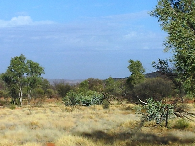
Rugged, wild and beautiful
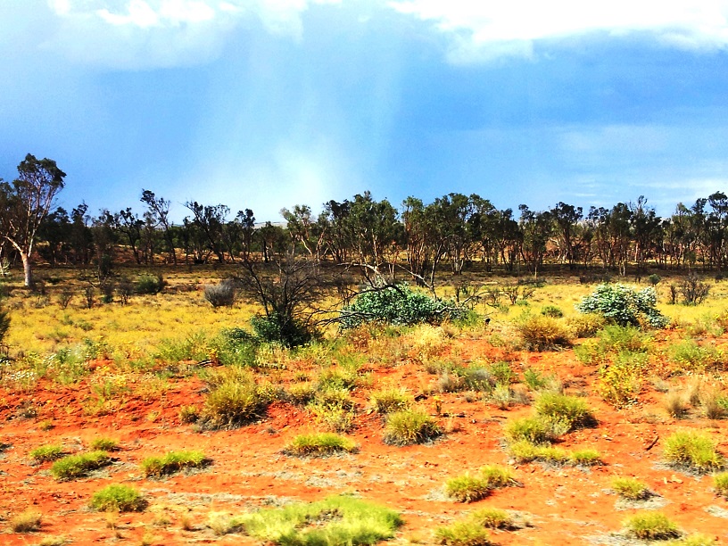
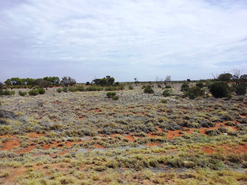
By 6:20 we were headed into the Red Center! I had always thought of the Outback as being a desert – very arid with lots of rocky sand and little vegetation. This land is very arid, an average of less than 2 inches of rain a year. This, however, is not a dessert. According to JJ it is, ”a semiarid scrubland” commonly known as The Bush – maybe because there were thousands and thousands of square miles of red, sandy dirt and bushes. Australia is rimmed by mountains and for the most part, the rivers flow inland where the water eventually disappears into the ground. “Where did it go?” you might ask. The answer is into two huge aquifers – underground lakes that supply the water for the interior, but it should be emphasized that both plants and animals have to work very hard to hydrate.
But I digress. As we traveled, 6 hours, we made several stops at cattle stations along the way. The first stop was a station and also a camel farm. (Camels were introduced to Australia early on by the Afghans. Being very suited to the climate and the terrain, the camels thrived. It is said that now there are more camels in Australia than there are people. Some are on farms but most are wild and free. We saw a small herd in the Bush as we traveled.)
The restroom at the first station.
Anyway, we stretched, visited the facilities, bought drinks (non-alcoholic) and of course went for a camel ride. That was interesting. It’s not a way I’d like to travel very far, but it was fun.
Yep, we did it! We rode a camel.Ahhh, he’s just a baby.
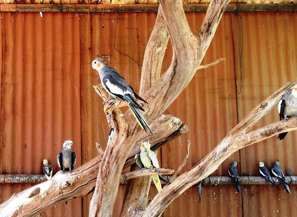
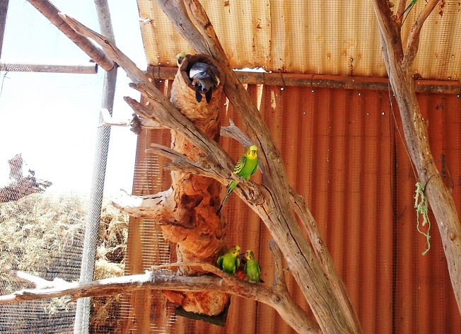
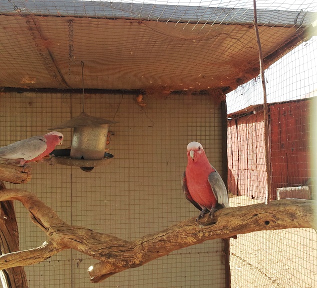
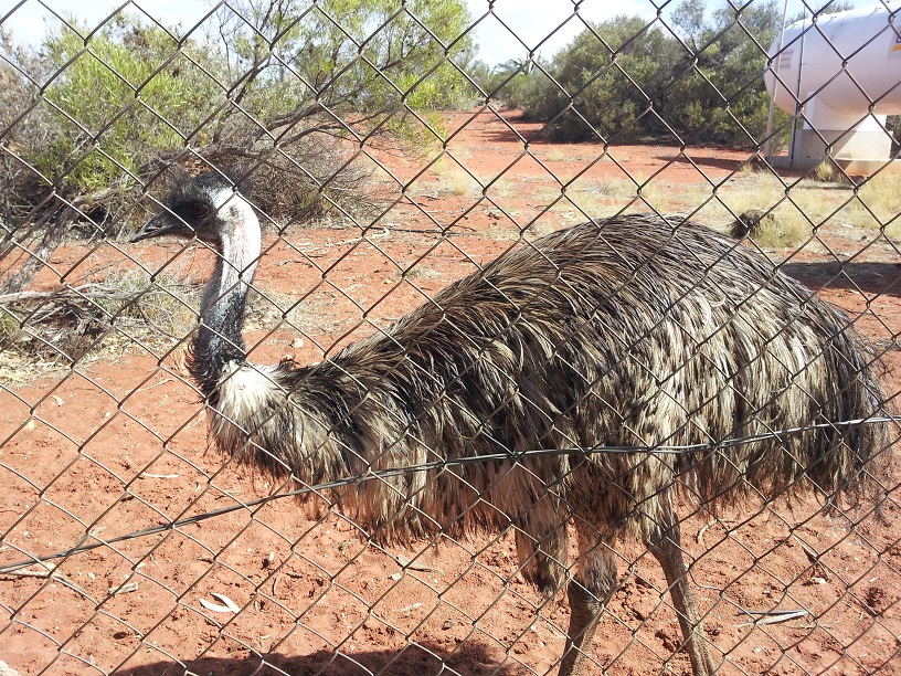
There was also an aviary with a variety of Australia’s parrot population as well as an emu – I took pictures.
ParrotsBut wait, there’s more.Australia is known for its diverse parrot population. We saw flocks of these in the wild.An Emu – JJ says their brain is about the size of their eye.
Back on the van and on through miles upon miles of bush land.
The BushWe passed this along the way. JJ called it Foolaroo – not nearly as beautiful as Uluru.More BushThe George Gill Hilton
As I said earlier, the trip took about 6 hours and we arrived at our campsite – a very long time since breakfast – in time for lunch.
In less than an hour we were off to our next excursion. I’ll write more about that in the next exciting chapter of Tom and Charli Down Under.
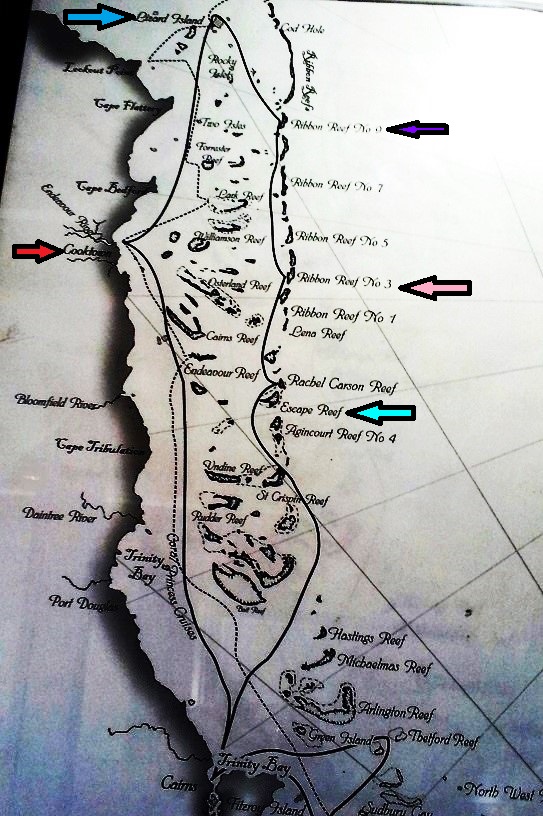
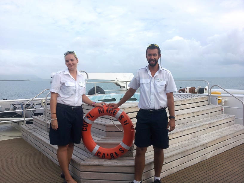
November 25 – 28 The Northern Loop of the trip on the Coral Princess II.
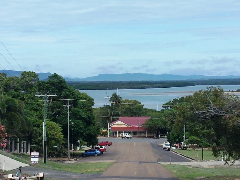
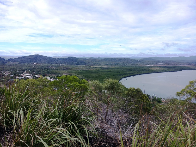
Cooktown as seen when coming down the hill.
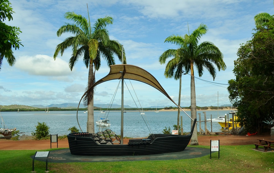
We traveled during the night and tied up at the dock in Cooktown, Australia, a sleepy little village named for Captain James Cook who stranded his ship on a coral reef just off the coast of the town. Stepping on to the shores of this town was like stepping back in time. We spent the morning in this pretty town which proudly displays its history with Captain Cook on plaques along a quaint little park that runs along the edge of the harbor and throughout the town.
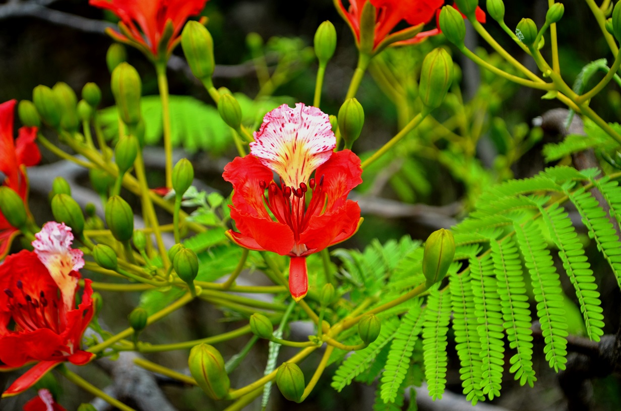
Joseph was Captain Cook. He kept a detailed journal. This is his documentation of the stranding of Captain Cook’s ship.Captain James CookA sculpture in the little park in Cooktown.Flame Tree
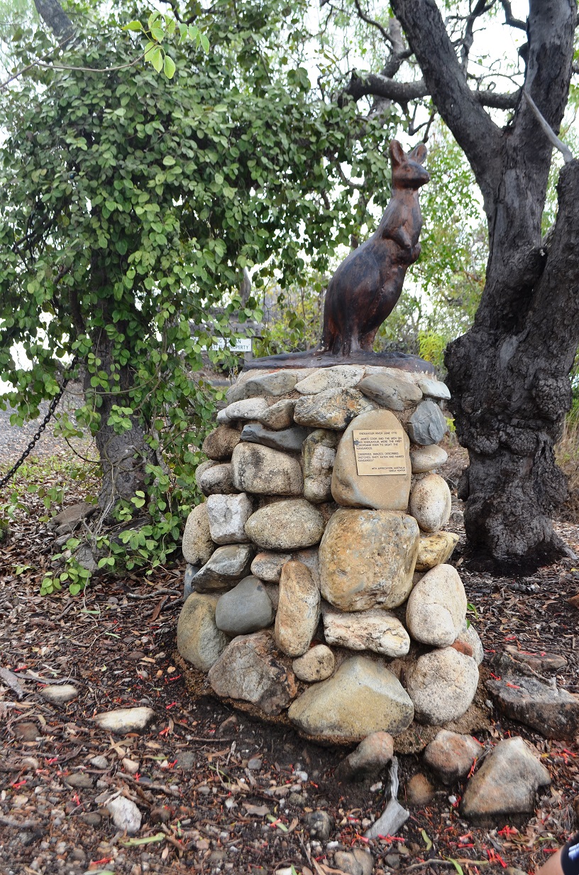
After strolling through the park, John (one of our new found friends), Tom and I headed to Cook’s Lookout. It was a good walk up a pretty steep hill which, with the great meals on board the boat, we needed. Along the way we enjoyed the flora, fauna, and the plaques describing Cook’s time in the area. I mentioned fauna right? Well, I was taking a picture of the red flowered tree
Kangaroo StatueCooktown from Captain Cook’s Lookout
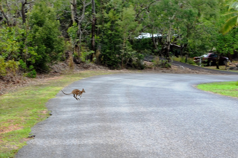
and I heard a rustling in the bushes. I looked just in time to see a kangaroo tail disappear into the bushes – my first kangaroo!!! John caught a glimpse too and we were very excited. At the look-out we took pictures of the kangaroo statue and the quiet and lovely scenery before heading back.
As we walked, we heard another thrashing in the brush and out hopped a small kangaroo right in front of us! John was fast enough to get a couple of pictures – very, very cool!
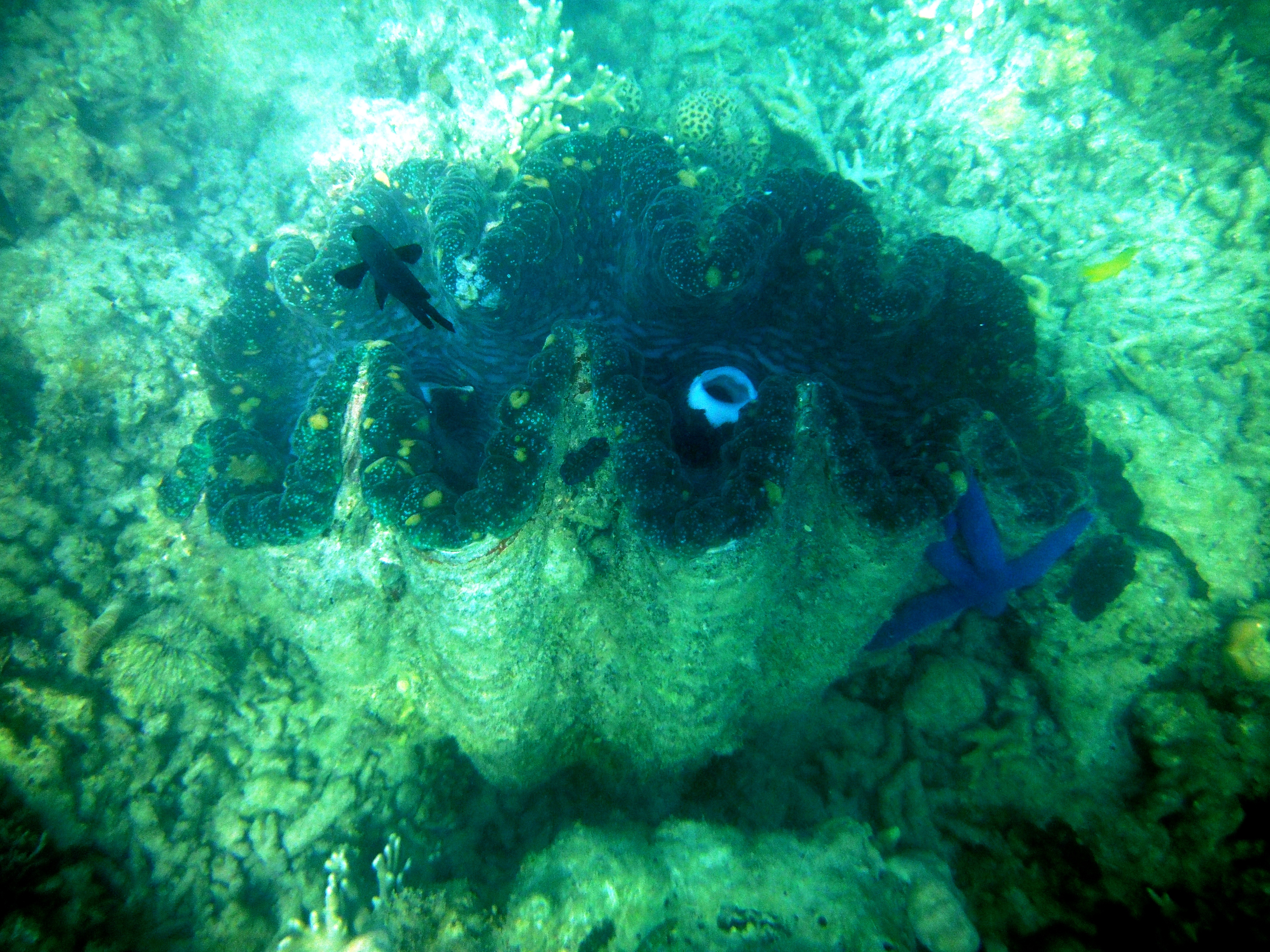
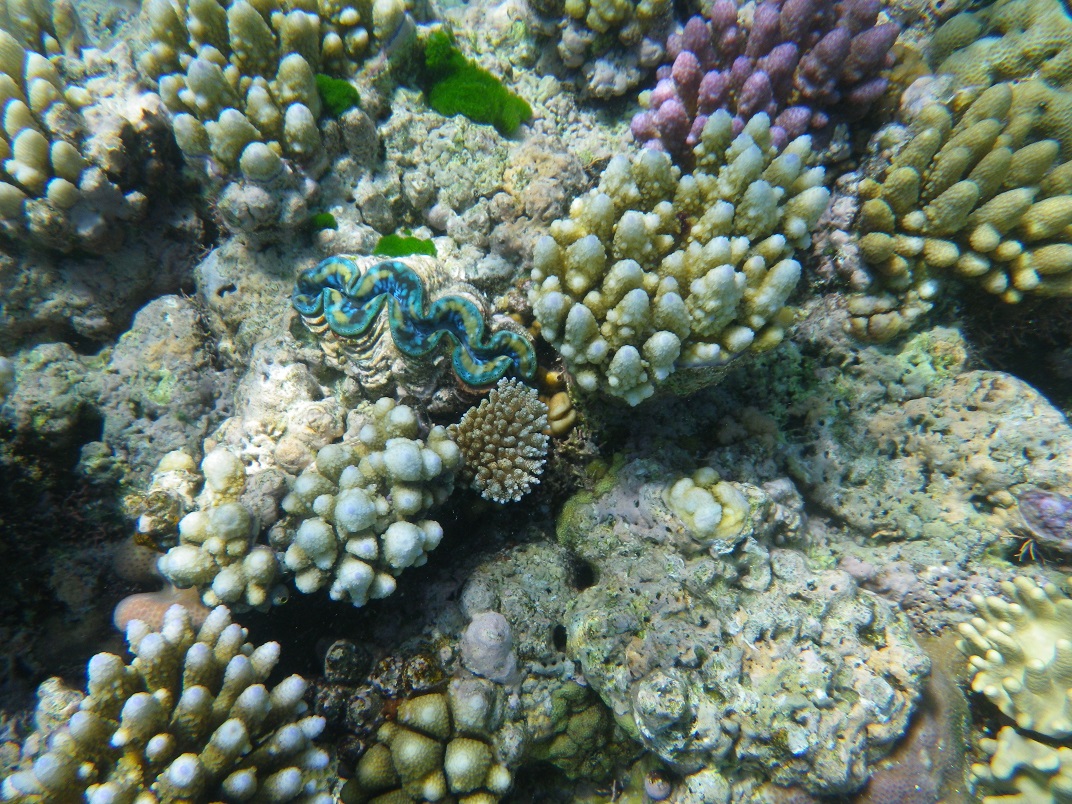
Our First Kangaroo!Giant Clam – This one was about 3 1/2 feet wide. Notice the large blue sea star on the side.The blue zigzag thing is the mouth of a small giant clam. They were everywhere and the colors were greatly varied and beautiful. Thank you zooanthellae.
Back at the boat we headed for our next snorkel stop off Lizard Island where we snorkeled from the beach. We dubbed the area “Clam Bay” because it was riddled with giant clams many of which were a meter or more wide.They were fascinating and beautiful.
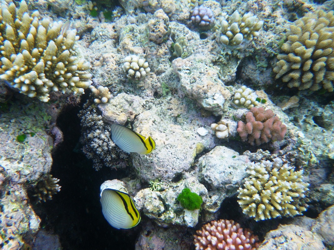
Butterflyfish usually travel as a couple – like us.
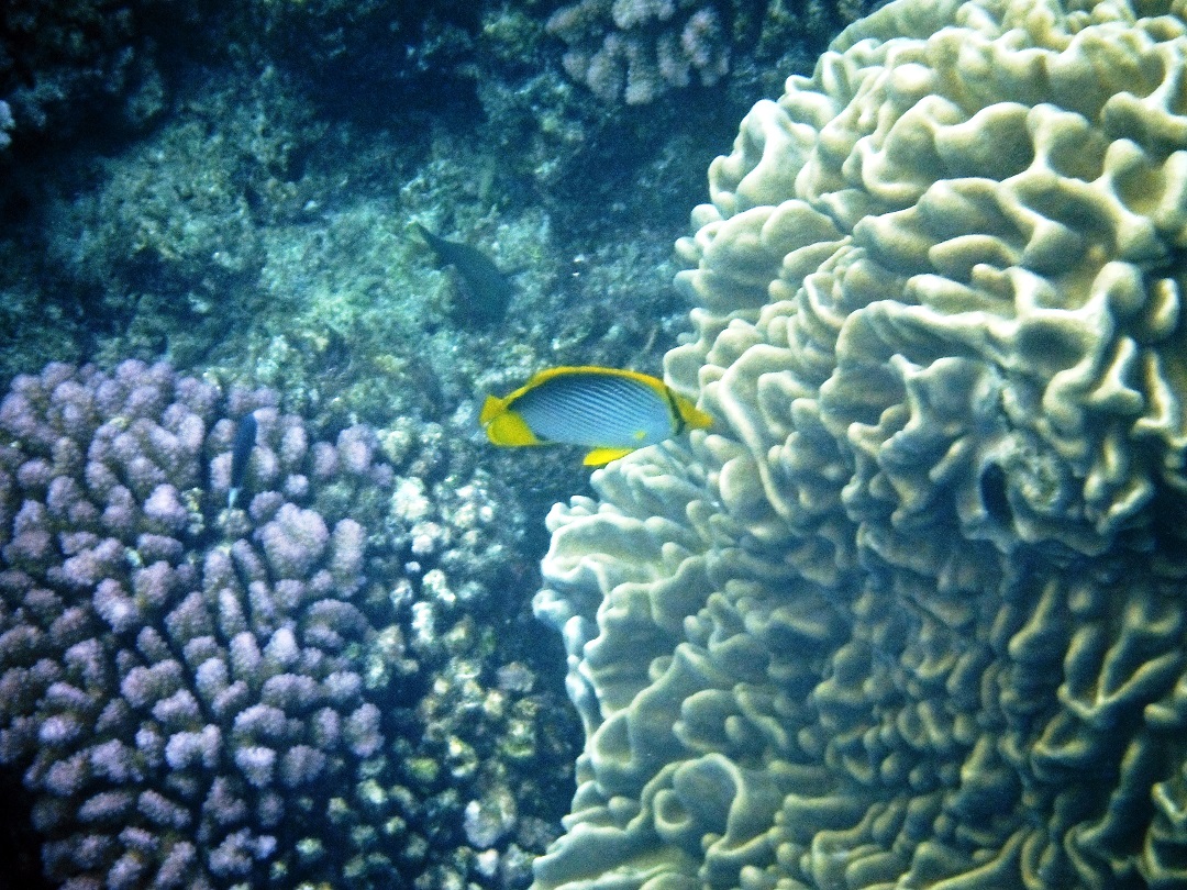
We later learned that the color of the much of the coral as well as the edges of the clams comes from an organism called zooanthellae which, to quote Jacob, moves into the edges of clams and coral. It creates a symbiotic relationship – it gets a place to live and it produces food for its host – nature is so complex and so amazing.
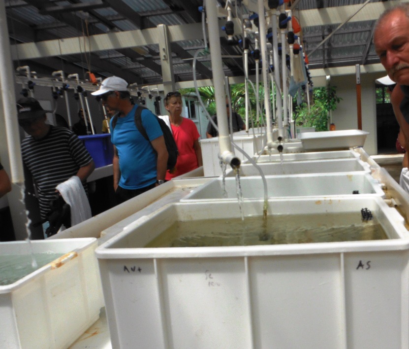
Later that day we went on an excursion to the Lizard Island Marine Research Center. That was also very interesting. Lyle, the director, took us on a brief tour and talked to us about the research that goes on at the center. People come from all over the world to conduct studies of the coral reefs, fish populations and the other profuse sea life on and around the reefs.
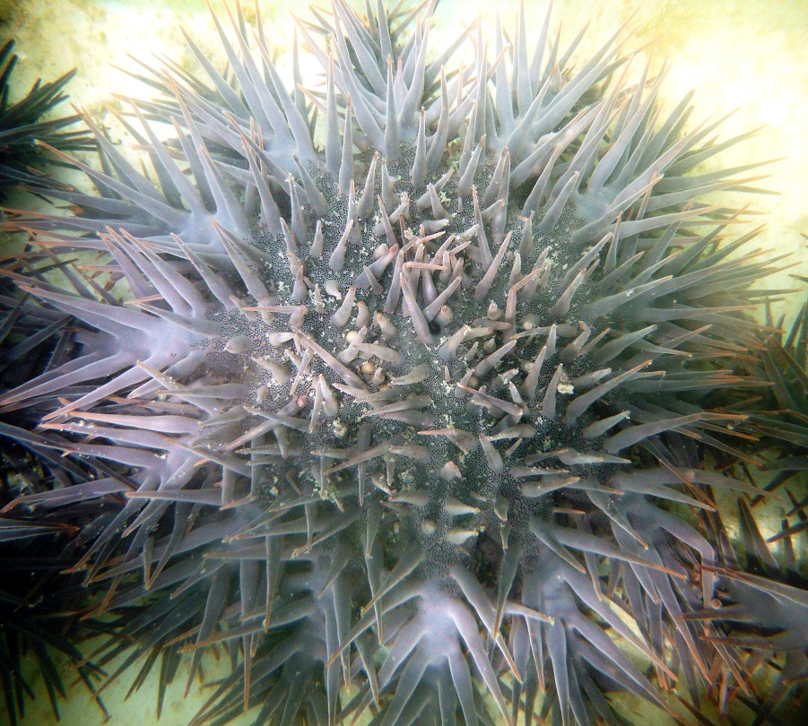
Kyle, the director of the research center, talked to us about the reef and the work being done to protect it.One of the research areas.This is a type of sea star known as a Crown of Thorns – beautiful but devastating.
He also talked about the Crown of Thorns sea star – very pretty, but devastating to coral reefs. They literally suck the life out of the coral and an infestation of them can destroyed 30% to 40% of an entire reef.
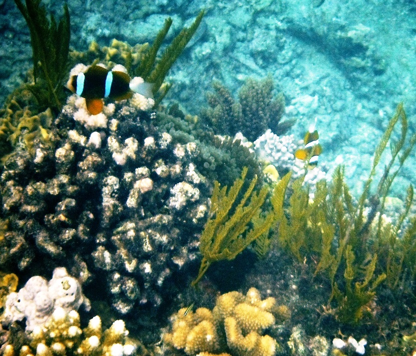
Anemone bedsSo tranquil.I could snorkel my life away.The side of the reef.
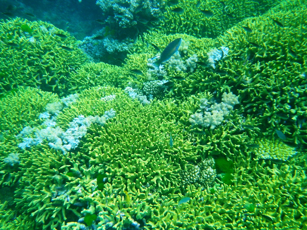
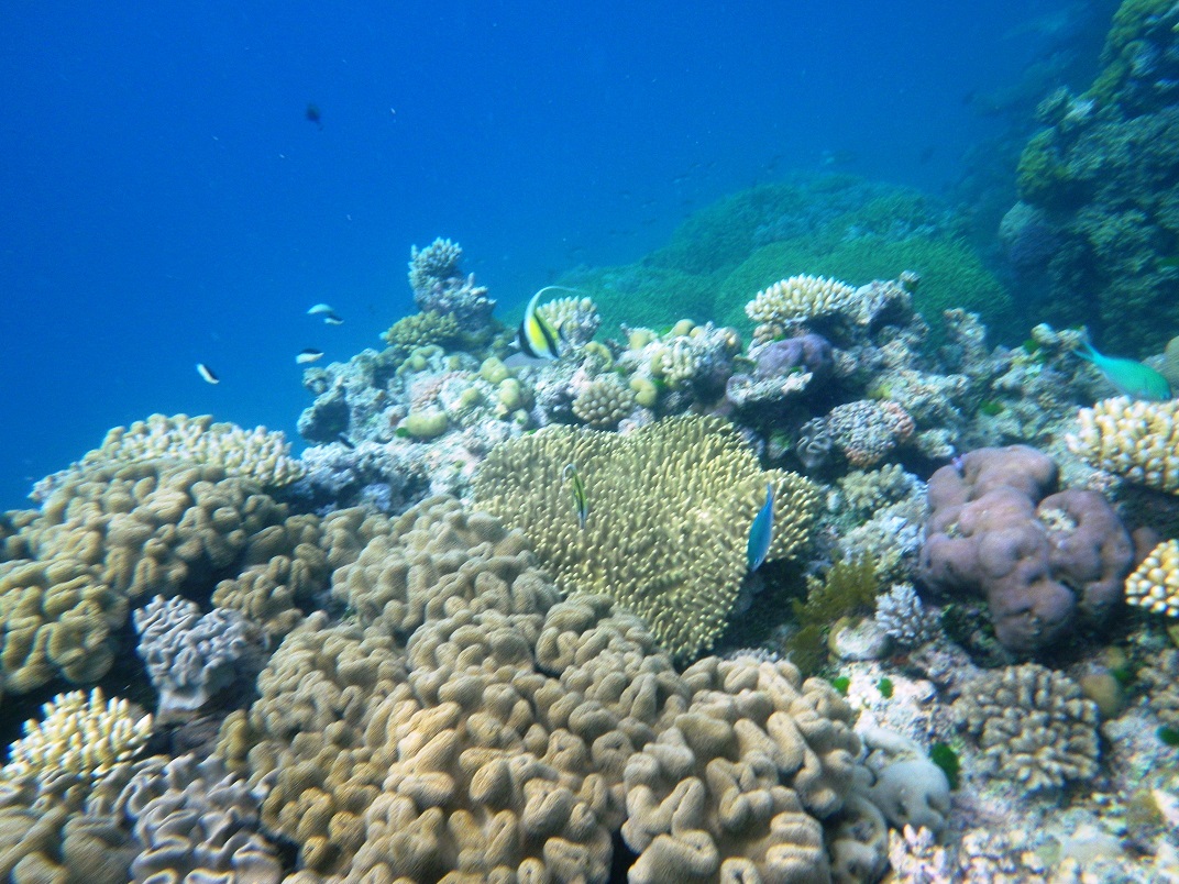
Our next stop was Ribbon Reef #9 – isn’t there a song about that? Anyway, we finally got some sunshine and the views were breathtaking! This was by far the best snorkeling yet and we spent hours paddling back and forth trying to see everything – huge varieties of coral, copious numbers of fish and other sea creatures. It was wonderful!!!!! We went to bed very tired but happy.
The larger fish is a Striped Surgeonfish and if you look just below him you’ll see a little Bluestreak Cleaner Wrasse. (Click to see close-up)
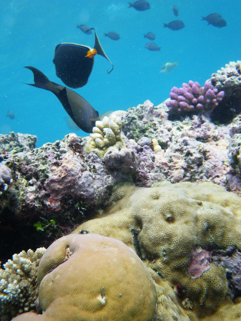
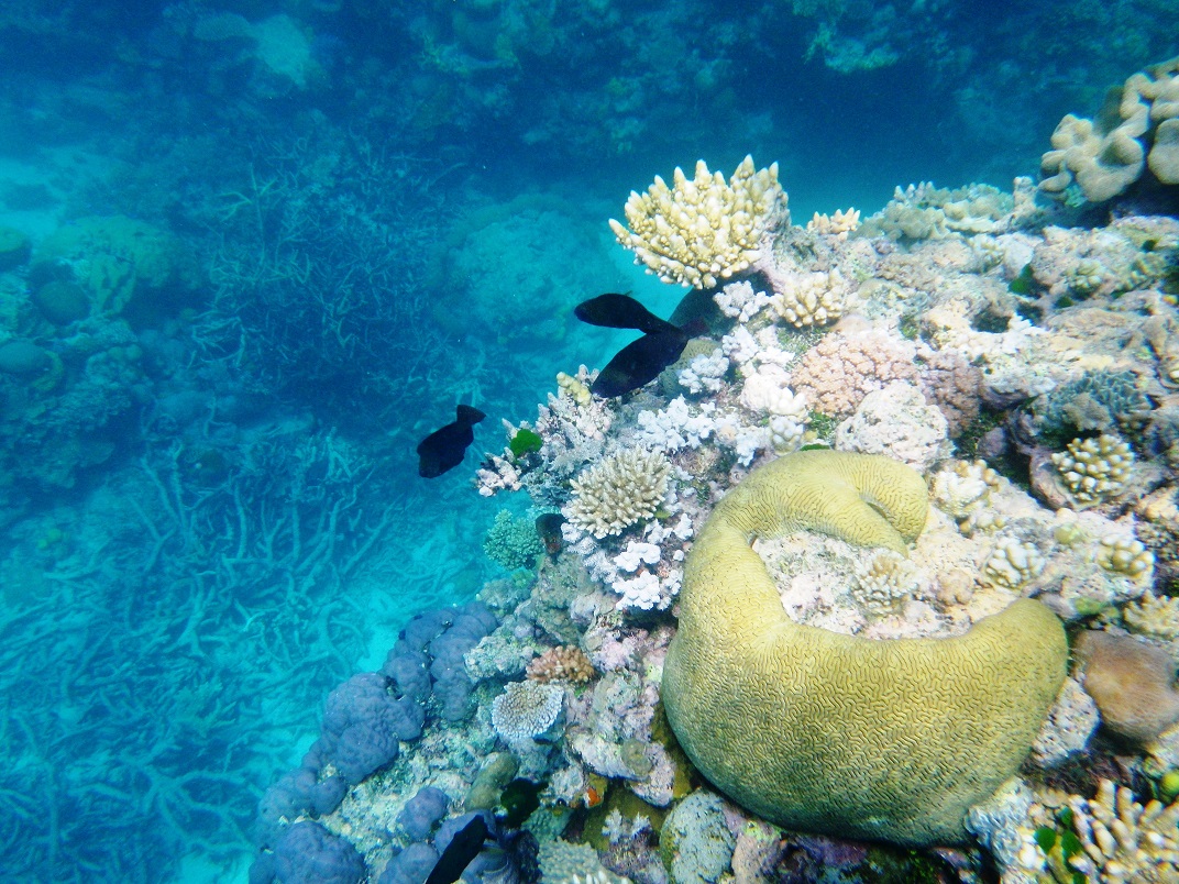
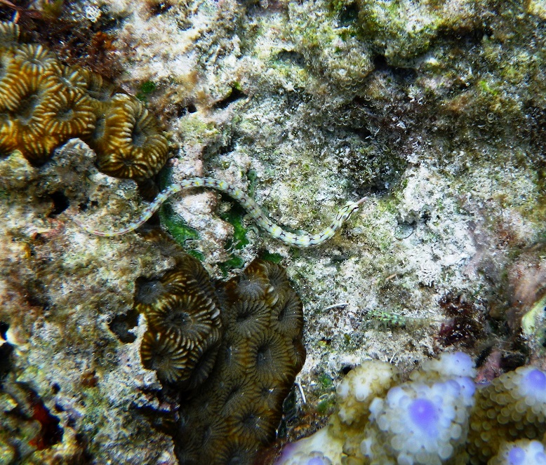
The next day we arrived very early at RIBBON REEF #3 – the one we had been told was the best and it surpassed its reputation!
Over the edge of the reef it dropped off to about 30 meters.Pipe Snake – look closely, this little guy was very pretty.The little clownfish were hard to catch. They’re very fast.
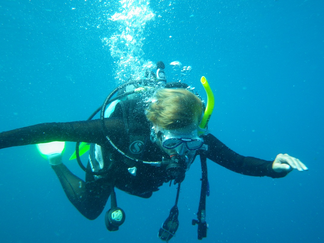
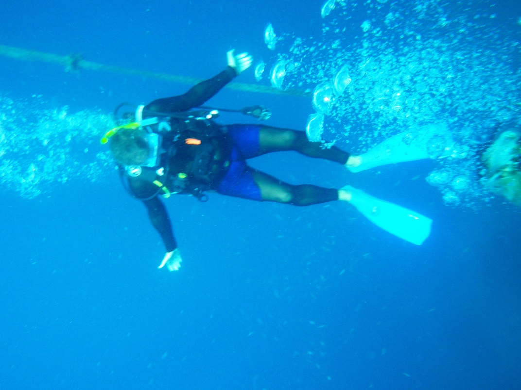
Tom and I started the morning with a dive – yep we went on a real scuba dive!!! And it was spectacular!!!!!!
Charli scuba diving.Tom scuba diving.This is Celeste – out patient and wonderful dive instructor and Jacob – our very knowledgeable marine biologist.Black-Backed Butterfly FishThe schools of fish were beautiful! (Click on the picture for an enlarged picture.)
We both did really well and it was an incredible experience! We swam through schools of blue-green damsel fish and saw a little puffer fish feeding along the coral wall. The sea life was prolific and magnificent.
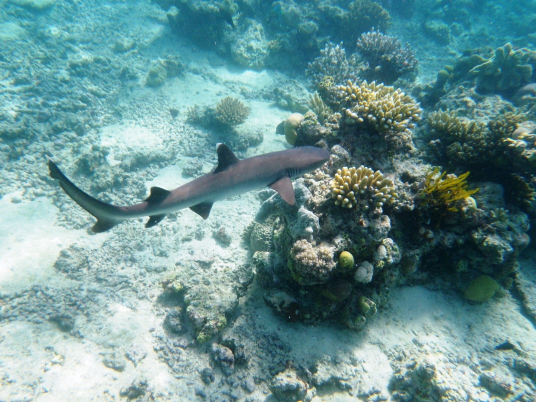
I swam with a shark!!! Well, I swam above him and watched him swim below – too cool!
After the dive, I spent another hour+ perusing the top of the reef where several of us followed a medium sized black-tipped shark for a bit – awesome!
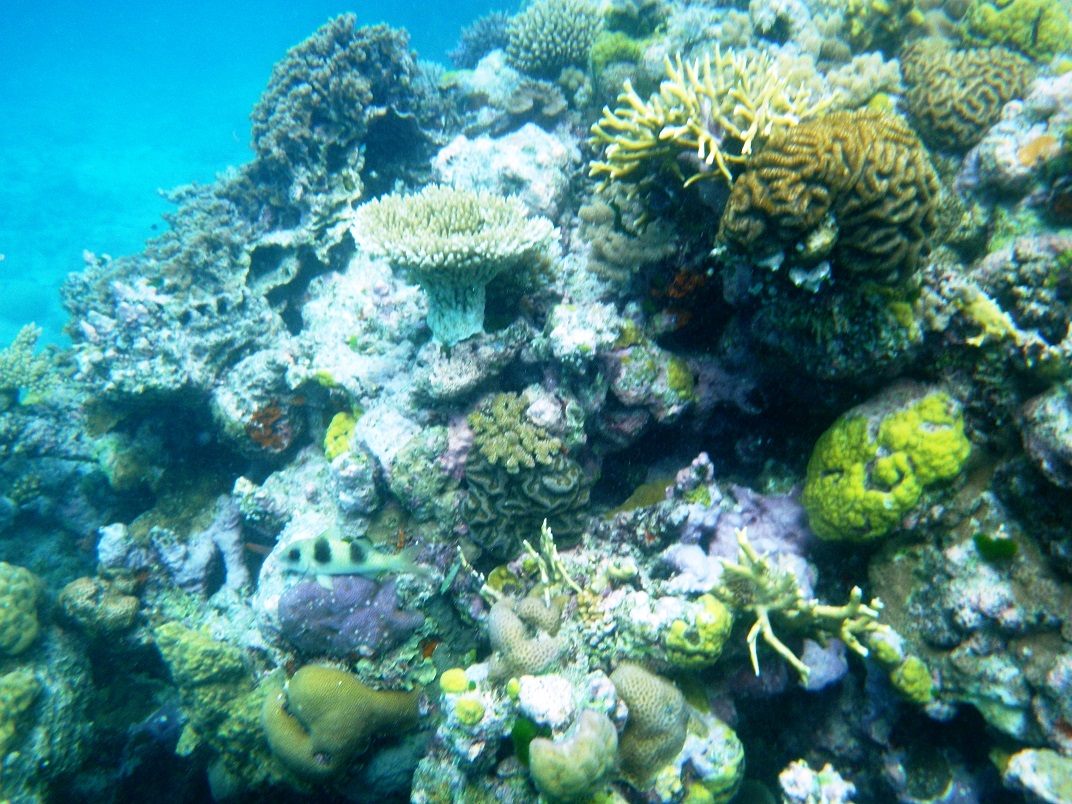
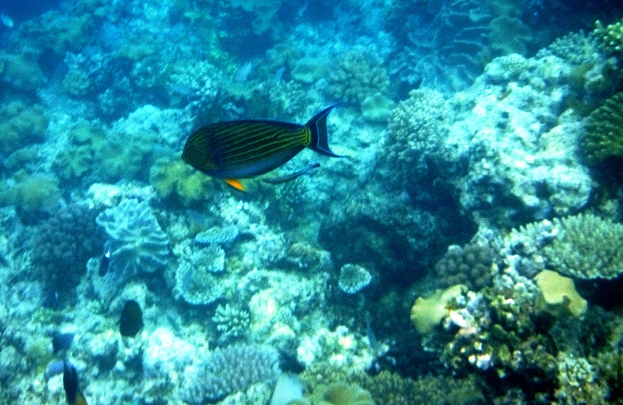
Then it was on to Escape Reef – the last snorkeling spot of our trip…heavy sigh. It too was spectacular and a great end to this part of our adventure – experiencing the Great Barrier Reef – check!